
Deer Lake Association
A member of the Minnesota Lakes Association
| Spotlight |
|---|
|
|
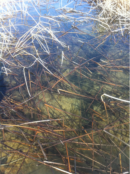
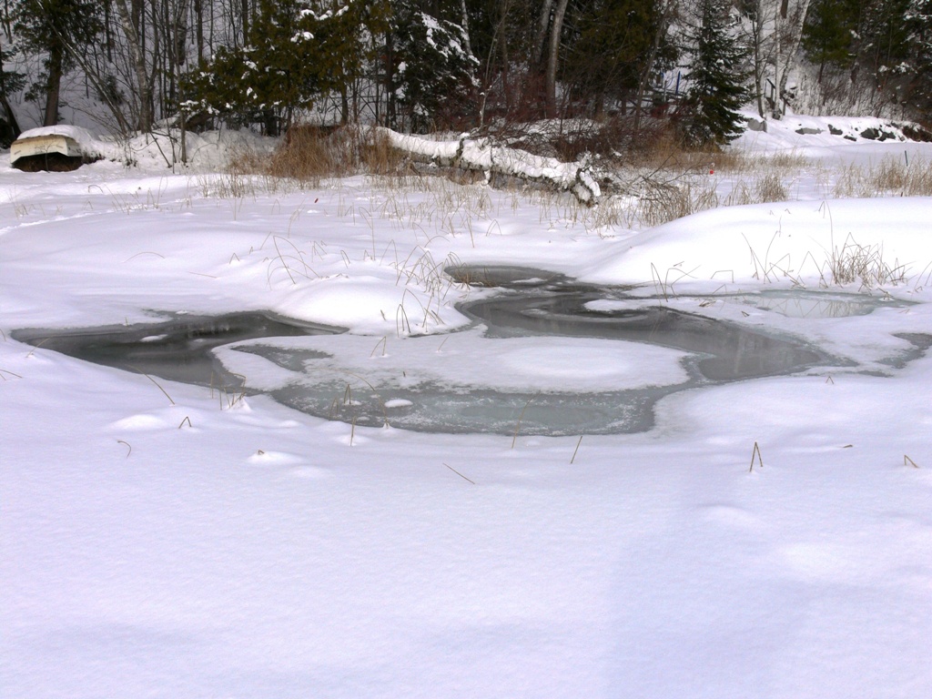
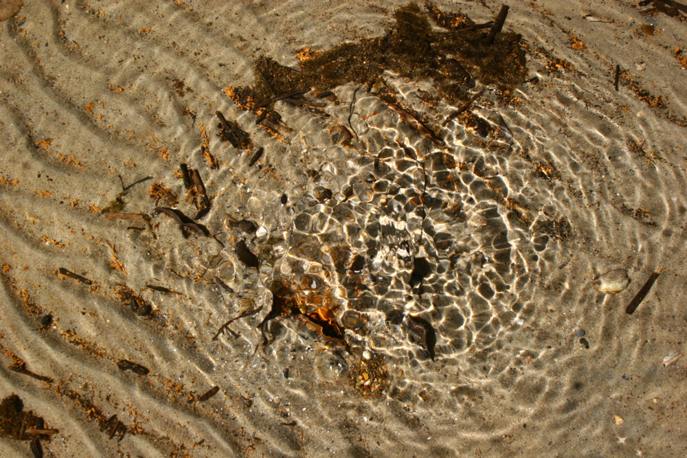
Springs in Deer Lake
Here are some photos of the Springs on the north shore of Deer Lake.
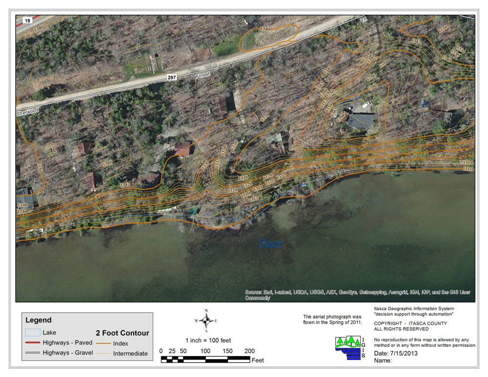
Here is an Arial of the 2013 Dignostic Spring Concentration Area:

Here is a link to an interview with Tom Nelson explaining the Spring Study, using many of the photos on this page:
https://www.youtube.com/watch?v=DwokNfTcdM8
******
Below is a photo documntry of the Spring Grid Experiment.
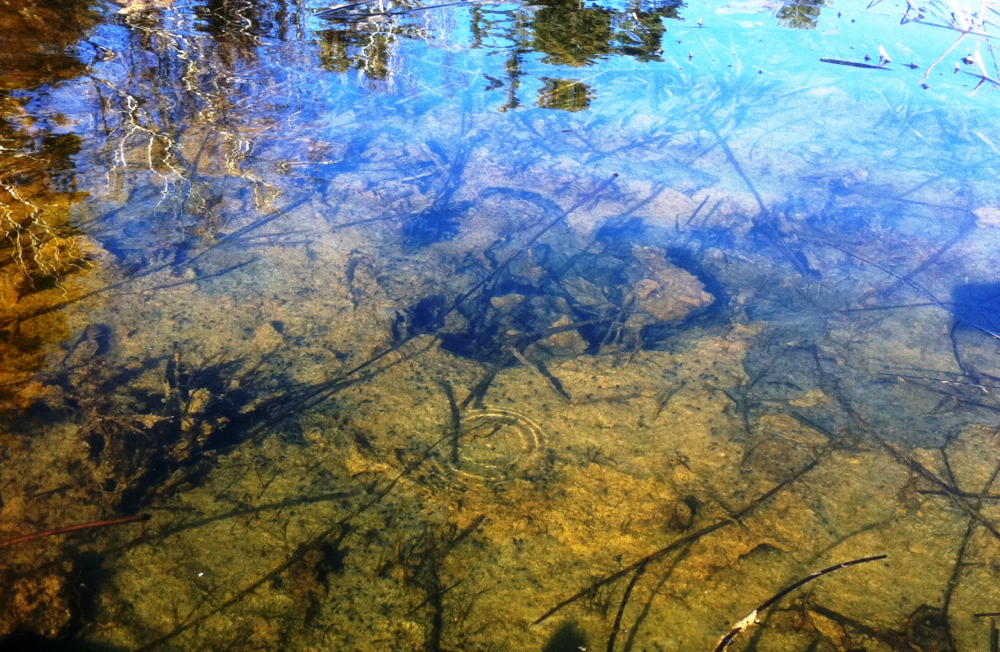
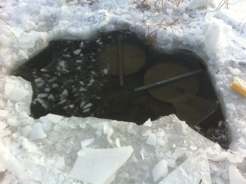
This remarkable spring is in 3 feet of water, 50 feet from shore in a dense reed-bed of Bulrush. It located along the same northern shore of Deer Lake, but is 1/4 mile distance from the study area shown above.
****
The topo-graph below is the end-product of the spring study.
It shows the temerature differentials found in the grid area, indicating groundwater intrusions, or underwater springs to varing degrees.
.jpg)
The blue topo grid above maps out the scientific area of spring study.
See below for more details on how it was done.
*****
Scientific study of Deer Lake Springs begins:
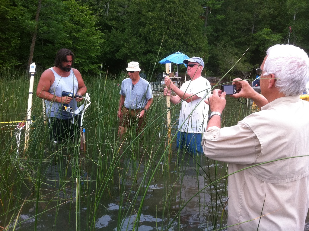
Calibrating instruments amid the June 30, 2012 Bulrush, and setting up the grid. (L to R: Rich Anderson, Bob Baker, Jack Jones, John Downing)

Grid Layout systematically surveyed for lake bed temperature.
.jpg)
Data recorded (by Mary and Pam); more thermometer sticks nearby.
***
Resultant grids with seepage meter locations.
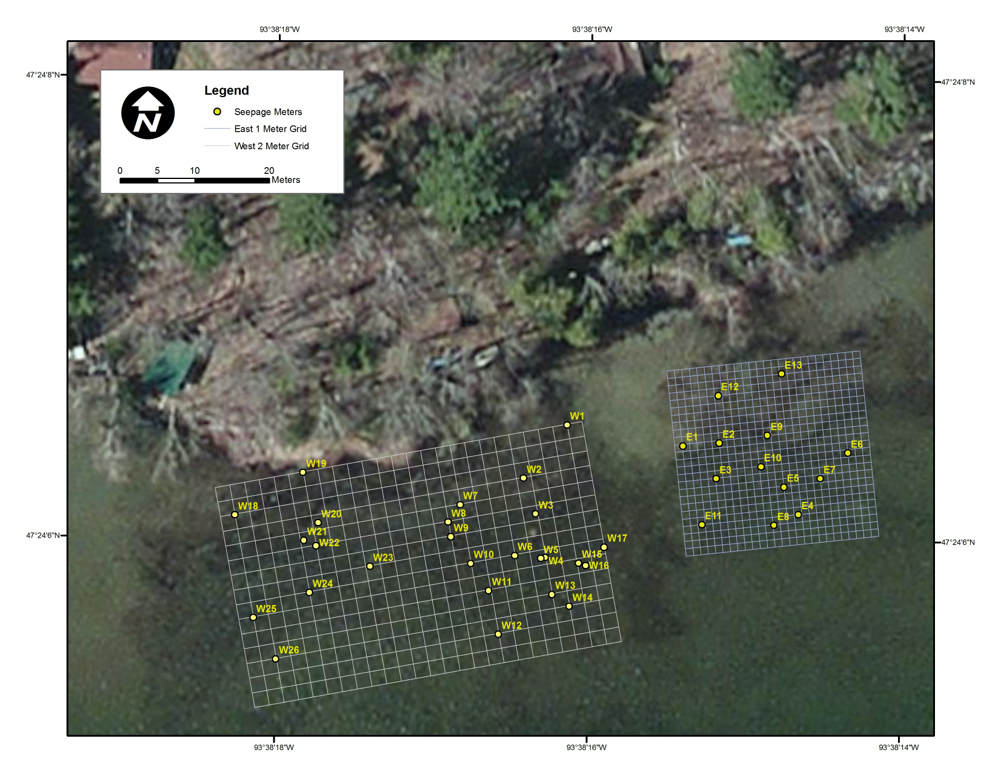
East and west grids, with locations of seepage meters signaled in with GPS coordinates. The west grid was 2x2 meters. The east grid was tighter, with 1x1 meter increments.
The blue grid below charts the collated data as a temperature topo map for the west grid.
Please note: north-south is reversed between the two maps.
On the topo, the Inshore is on the bottom, with south on top, 25 feet into the lake.
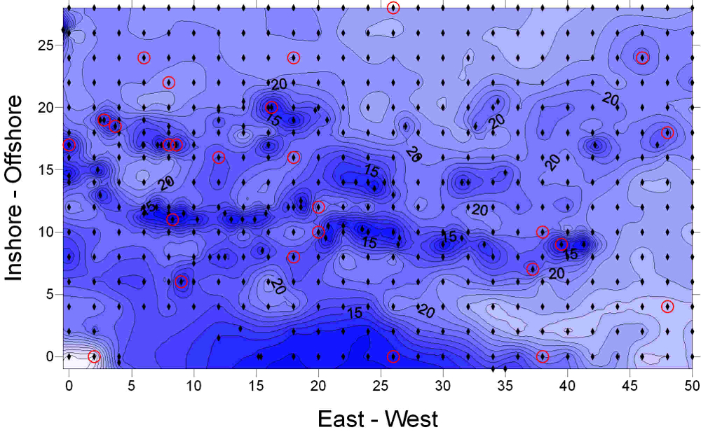
West Grid with temeratures mapped as topo.
Inshore= north ; Offshore=south
Flow rates from randomly located meters on the grid at various temperatures are extrapolated to the entire grid to measure groundwater discharge over entire area. Discharging groundwater is colder than ambient lake water in summer: the colder the temperature (bluer on map) the more groundwater influence.
***
The two grids seen from above at freeze-up in December. Infrared phototograph shows groundwater intrusion as warmer than ambient lake water temperature.
The topographical land formation behind the springbed.
****
Meters on the Grid
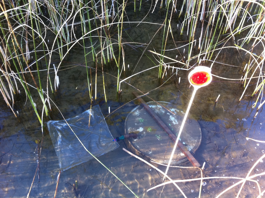
Meter with bag attached is timed for seepage rate.
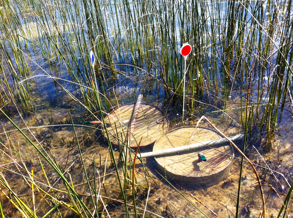
Twin meters over a discharge trench.
Located: Offshore=17' x 8' E-W on grid maps.
Springs are not just point source holes (see top photo), but also linear folds or veins of more porous material (e.g. sand layers between clay).
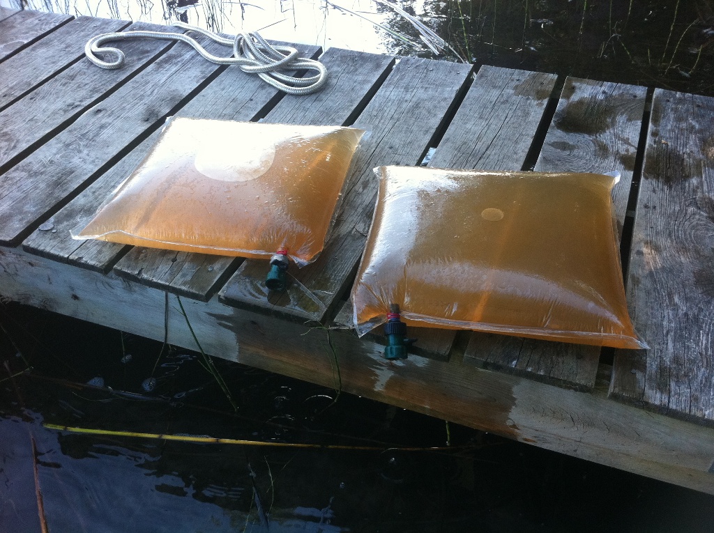
Some meters have prolific flow rates.
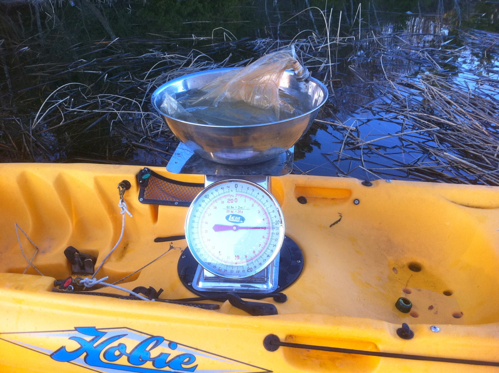
Water weight = water volume.
***
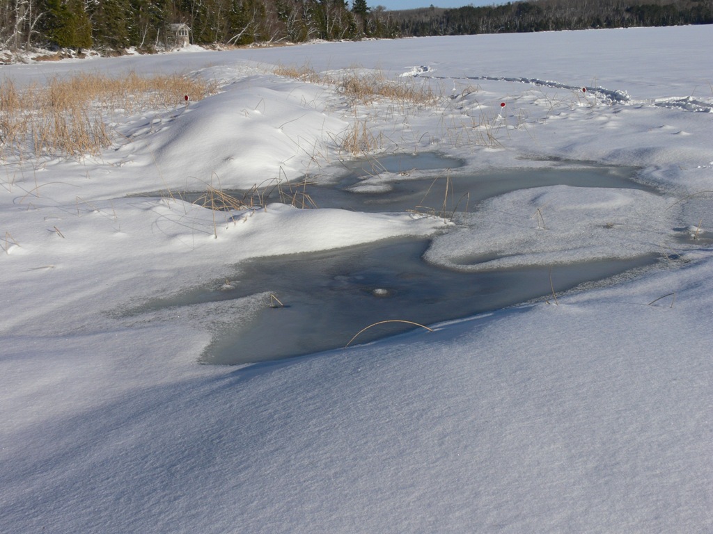
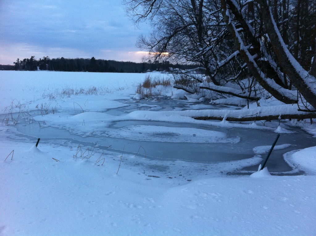
Study continues through the winter
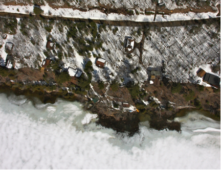
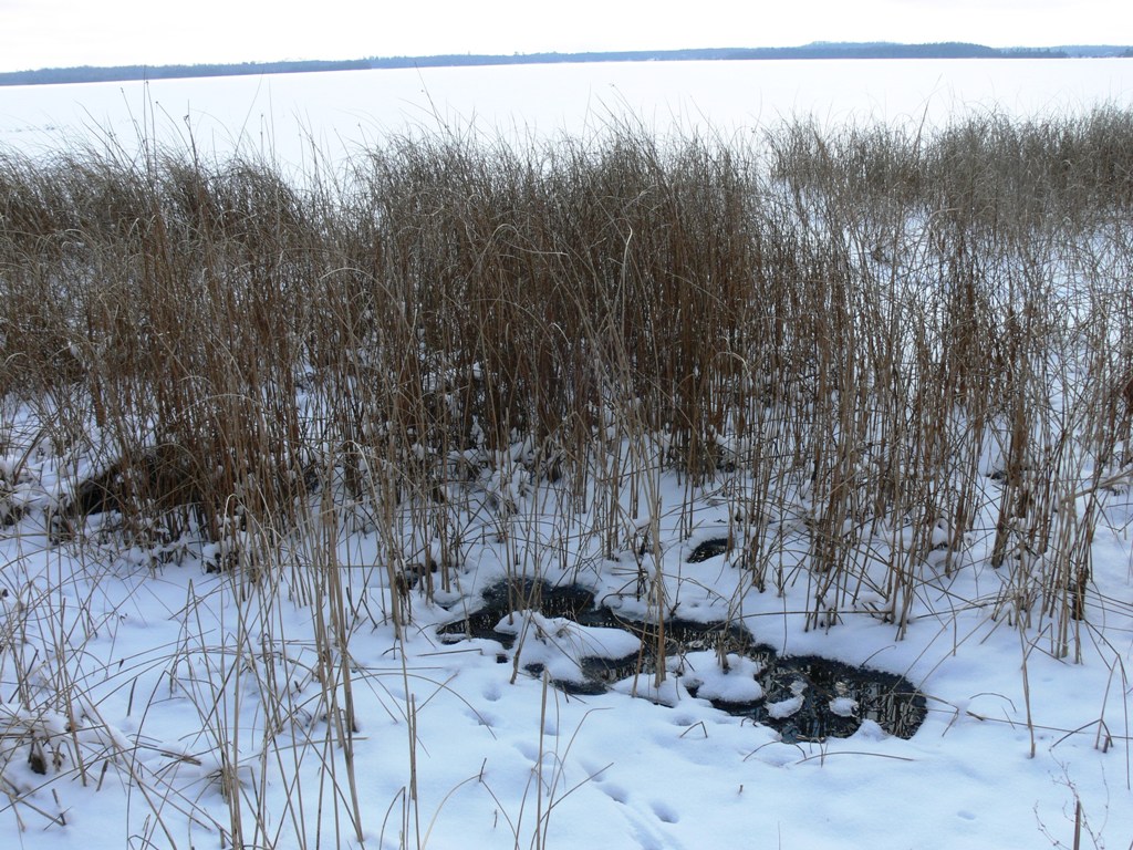
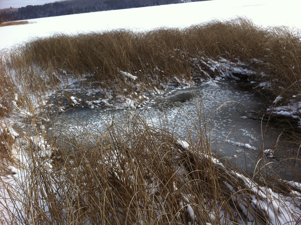
Springbeds in Winter are easy to find!
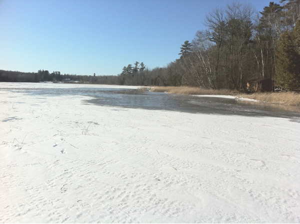
East grid area, with meter flags visible.
East Grid area 30-40' from shore.
West grid area, 15' from shore
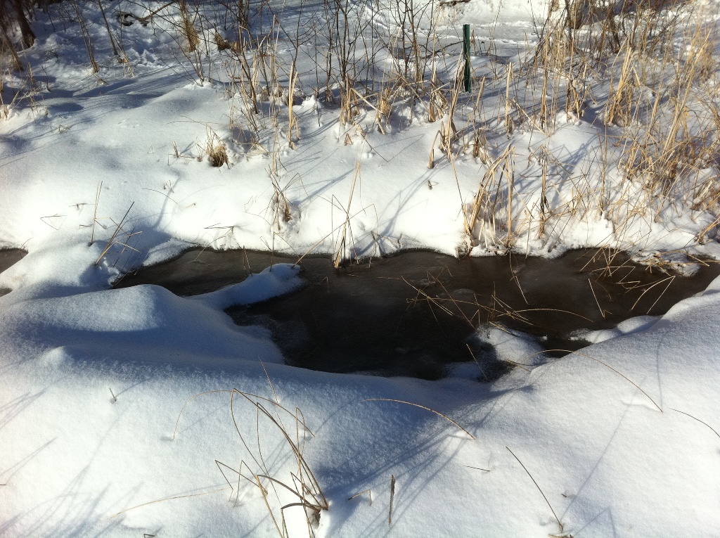
West grid area, 10' from shore (nb: grid stake).
Spring hole in dense Bulrush reedbed 50' from shore, 3' deep: see top photo for summer view.
West grid area from shore to 30' (note grid corner post)
The entire grid area looking west in early spring.
*******
Data collection in winter limited to only a few meters.
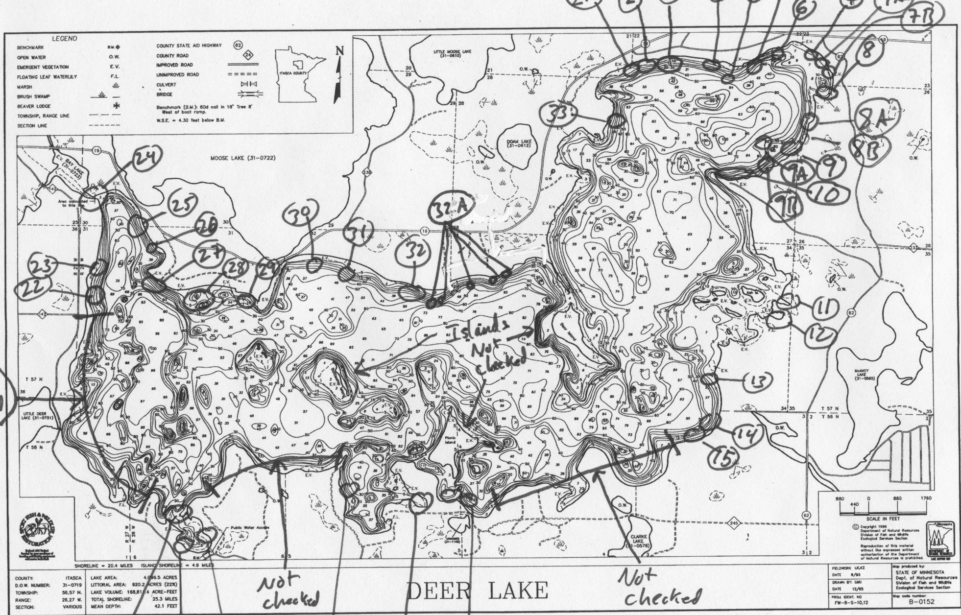
The map of Deer Lake above shows where evidence of spring activity was spotted in the winter, during a stroll around the lake on the ice.
If you know of springs along your shore or in the water, please report to:
Tom Nelson (Spring Study Coordinator) 218-246-2588